


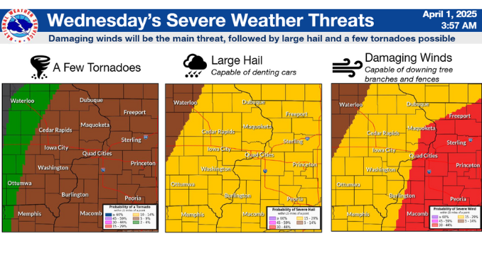
The National Weather Service is Watching the Potential for Severe Weather for the area. At this time the Storm Prediction Center has put a Level 3 or an Enhanced Risk has been issued for South Eastern Jackson County, along with Eastern Clinton, and Scott counties. The rest of the area is under a level 2 or slight risk. Damaging Winds, Large Hail, and isolated tornadoes are all possible. The timing of this appears to be early Wednesday Morning. The storms will be moving to the Northeast at 50 MPH. Stay with KMAQ and we’ll keep you updated on this chance of severe weather.
Stay Connected with 95.1 KMAQ
Add 95.1 KMAQ as a preferred source on Google to see more local news, weather, and sports in your feed.
Follow us on Facebook for breaking news, severe weather alerts, sports, and more.
